Toggle navigation
Aircraft
Explore
Aircraft Types
Airlines
Airports
Owners
Current Activity
Latest Activity
Today's Activity
Newest by Category
Latest accident
Today's Accident
Latest incident
Today's Incident
Special Highlights
Upcoming Flights
Search
Statistics
Tools
ACARS translator
METAR translator
NOTAM translator
Geoid Height Calculator
Marines
Explore
Captains
Races
Current Activity
Latest Activity
Today's Activity
Search
Statistics
Trackers
Explore
Current Activity
Latest Activity
Today's Activity
Search
Statistics
Satellites
Statistics
About
About The Project
Exporting Data
Spotter TV
English
English
Deutsch (βeta)
Español
Français
English
Deutsch (βeta)
Español
Français
Leaflet
| Map data ©
OpenStreetMap
contributors,
Open Database Licence
17:30:04
17:49:44
Altitude (m)
0
2000
4000
6000
8000
10000
12000
Speed (km/h)
727.8000000000001
728.0000000000001
728.2
728.4000000000001
728.6000000000001
728.8000000000001
729.0000000000001
729.2
729.4000000000001
729.6000000000001
729.8000000000001
730.0000000000001
730.2
17:30:04
17:49:44
Not Available
CSG2538 - Not Available
Additional Data
Detailed
Download Flight Data
CSV
RSS
For Advanced Users
JSON
XML
YAML
PHP (serialized array)
For Geo/Map Users
KML
GeoJSON
GeoRSS
GPX
WKT
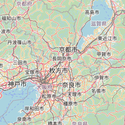
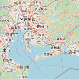
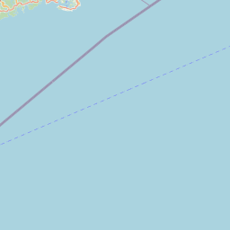
Flight Information
Ident/Callsign
CSG2538
Airline
Not Available
Aircraft
Not Available (NA)
Registration
NA
Additional information as it flew nearby
Date (Asia/Tokyo)
Oct 26, 2024 2:29 am
Date (UTC)
Oct 25, 2024 17:29
Flight spotted duration
12:03:00
Latest ACARS message
Array